Skip to content

Undergraduate Student Research Assistant Recruitment for GeoBlockchain Learning and Development

The HGIS Lab (https://hgis.uw.edu) is recruiting two to three talented student assistant volunteers to join our “GeoBlockchain for vulnerable population” project. We are looking for disciplined students to assist in the development of Decentralized Web Mapping Application aimed to support the vulnerable populations in the U.S. Students will get involved in both front- and back-end development of the application. Prior experience in blockchain development is preferred but not required.

Responsibilities:

  • Attending virtual meetings with the team member led by the Principal Investigator Dr. Bo Zhao.
  • Developing the front-end side of the application including web designing and UI/UX designing.
  • Developing the back-end side of the application using Blockchain technology.
    Other duties as assigned.

Qualifications and Skills:

  • A current undergraduate student at the University of Washington
  • Demonstrated proficiency in JavaScript, HTML, and CSS
  • Demonstrated proficiency in Server-end JavaScript (e.g., node.js)
  • Familiarity with blockchain technology and how it works (preferred)
  • Demonstrated knowledge of Ethereum Blockchain and Smart Contracts (preferred)
  • Prior experience with website design and web mapping development (preferred)
  • Must have the self-motivation to learn new technologies, software, methodologies and assist Team to operate at maximum efficiency
  • Must pay strict attention to details and Information Security

Position Type and Expected Hours of Work

This is a volunteer position. Days and hours of work are very flexible, but students are expected to spend at least 5 hours/week and work remotely.

If you are interested in this project, please send an email to Dr. Bo Zhao (zhaobo@uw.edu).  It is a limited opportunity; we will prefer to work with students who contact us first.

COVID-19: Novel Coronavirus Infection Map

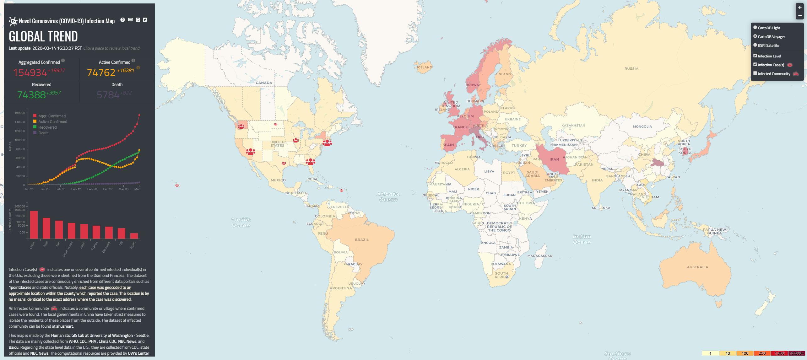
The HGIS lab team is developing a Novel Coronavirus Infection Map. This online interactive map enables users to track both the global and local trends of Novel Coronavirus infection since Jan 21st, 2020. The dataset is timely collected from multiple official sources and then plotted onto the map. Access to the current version of the map is available here.

The source code and more information about this map, including data sources and contributors, can be found here.

This is an ongoing project, and members of the HGIS lab are currently adding updates to the map day by day to improve the functionality. Our website features a choropleth map and a situational heatmap at present to visualize the prevalence and incidence of COVID-19. We welcome any suggestions to make this a better web map for our users.

If you have any questions or concerns, please contact Dr. Bo Zhao via zhaobo@uw.edu for more information.